Network Rail Data lake
Client:
Partners:
Sector:
GIS processing and data analysis
The context:
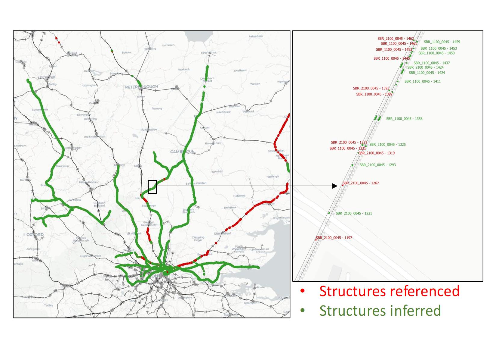
Our client (Network Rail) manages the rail infrastructure in the UK. Theirs assets (rail, overhead structures etc.) properties are stored in a central database. Modern measurement systems embedded in high speed trains enable to measure some properties of these assets, like the height and stagger of an overhead electrification line at a given location for example. These systems give very accurate location of the measurements but generally fail to identify the structure they measure. On the other hand, the central database lacks geolocation information for most of the structures. Our team (CPMS, EY and OpenDC) developed for NR and advanced process to infer the missing data and give access to country-wide geolocated insights through a dedicated secured online dashboard.
What we did:
We collated historical measurement data from hundreds of different Excel files provided by NR. We cleansed the data and developed a geoprocessing algorithm enabling to infer the missing geometries of the structures in the central database. Pattern recognition, regular expressions, basic geometric operation and advanced geoprocessing algorithm have been put together to infer and complete most of the missing information in our client database.
The value for our client:
Our product enables now our client to identify the structures when measurements show defects. Staff can be sent on site to fix or replace the structure before the defect becomes too important. This now limits the risk of structure failures that have costed our client millions of pounds when it happened in the past.