Mobility diagnosis in Seine-et-Marne
Client:
Partners:
Sector:
Data analysis
The context:
The Seine-et-Marne department (77) is the largest department in the Paris region, occupying almost half the area of the full region. It is made of a mix of rural areas as well as dense areas or under heavy development (Marne la Vallée sectors including Disneyland, etc.). The local authority stakeholders wanted to get a global vision of the mobility patterns in this inhomogeneous territory as well as an understanding of its public transportation gaps, without having to run a long and expensive survey.
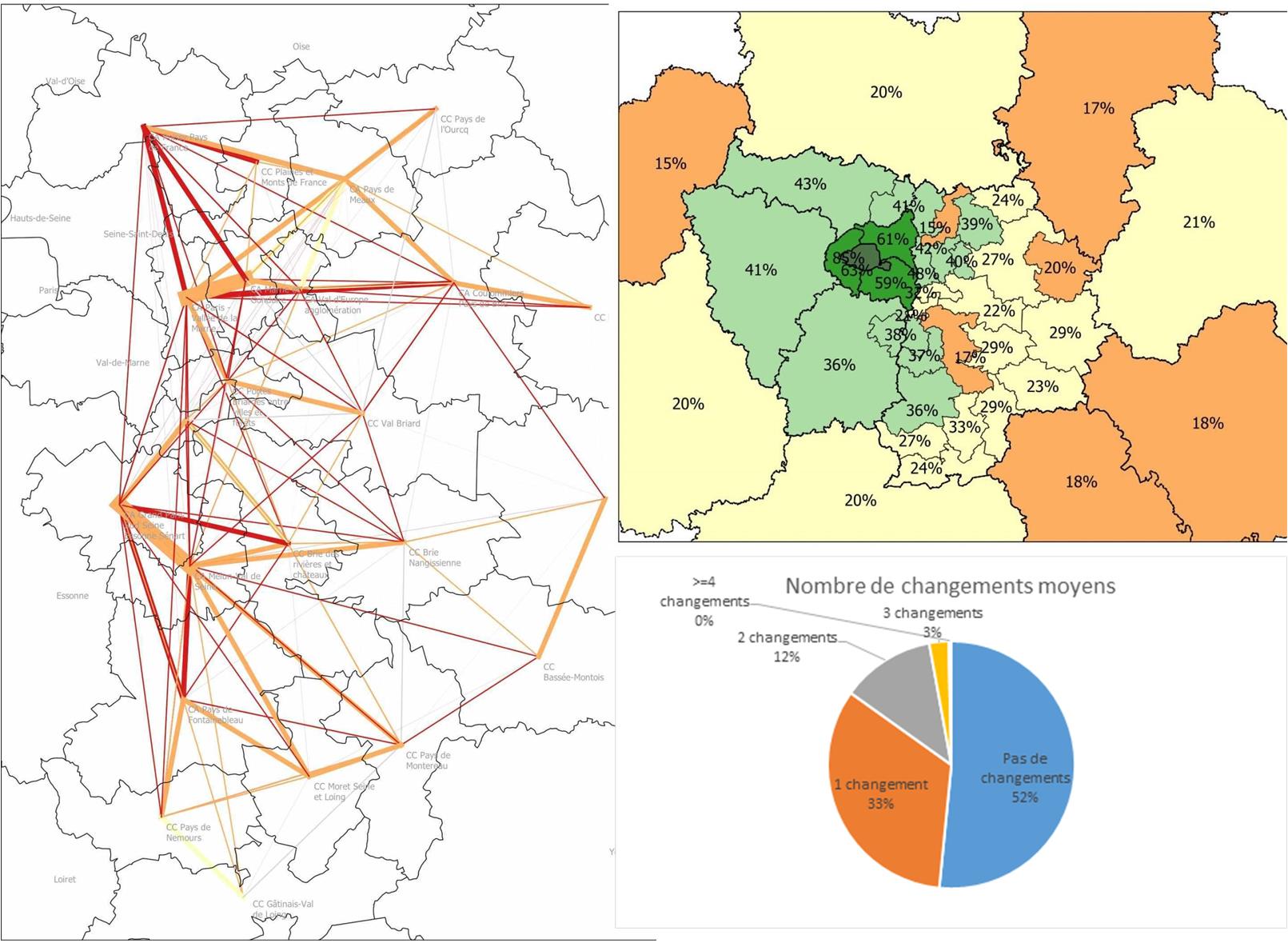
What we did:
We processed existing data sets, open data such as commuters data base from INSEE 2018 and 2010, and API data such as the Google Maps Direction API data in order to map out the main commuter flows in the department, the type of transport modes used and the differences in travel time between transport modes. We have run a flow evolution analysis on the territory between 2010 and 2018 and have highlighted the areas with significant gaps in terms of public transports (high flow demand vs low transport accessibility or high number of connections).
The value for our client:
Our client was provided a quick diagnosis of the mobility patterns across a wide area, without having to run an expensive survey or wait months for the analysis outcome.