Qualigeoenvi
Client:
Sector:
Web development
The context:
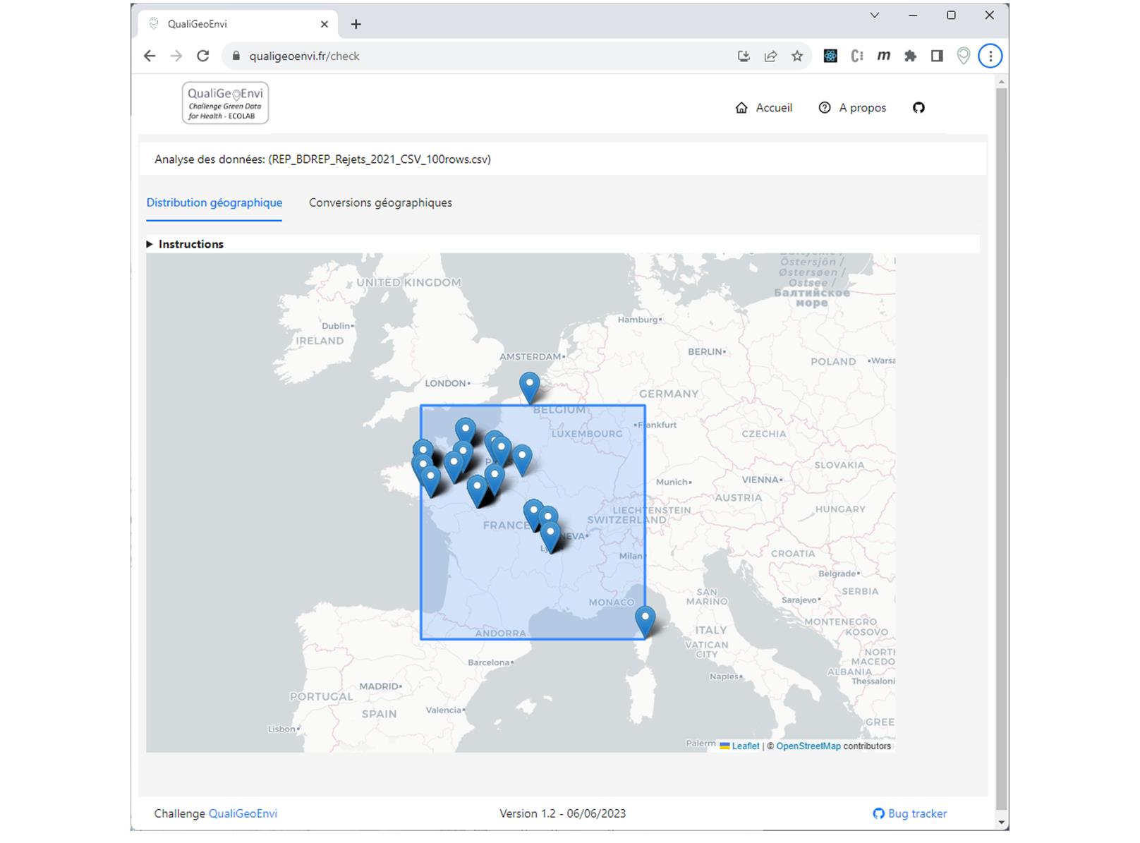
The Challenge Green Data for Health, launched by the Ecolab of the French “Commissariat Général au Développement Durable”, was launched to produce new tools to better mobilize environmental data for health-environment applications. 15 public administrations presented a challenge they face in their daily activities, that could be solved with data. Ou challenge holder INERIS use environmental datasets containing geographic information such as coordinates (longitude, latitude or projected coordinates) or addresses that often need a review before being published. Many people using these datasets are not familiar with GIS software or data analysis tools. They needed an easy-to-use tool that could quickly highlight inconsistencies in the geographical data from their dataset.
What we did:
As part of a team of three people, we developed a fully open-source web application qualigeoenvi.fr, working on any modern browser and enabling the load of any tabular data with geographic information. This tool infers the geographic fields, highlights the data geographical bounds (enabling the quick detection of outliers) and operates address to latitude/longitude conversion. It also computes the distance between addresses and coordinates when both information are available in the dataset.
The value for our client:
Thanks to this challenge, our client could benefit from the expertise of three people to develop a functional solution in less than two months. The web application being freely accessible, anyone in their institution and outside can use it at no cost. The application being fully open source, it can evolve in the future with new features.